~Sorry for the lengthy message, guys. I want to provide as comprehensive a picture as possible gradually from the purchase.
I received it yesterday.
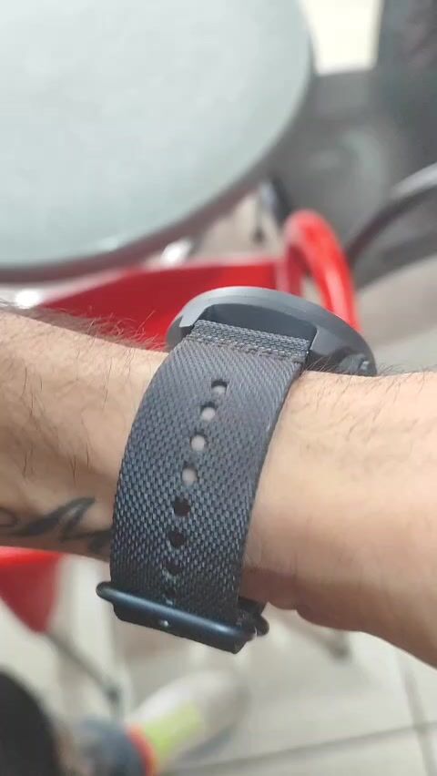
The first impression it leaves you with is quite good in terms of construction and quality. It has a fabric strap which I believe is better for sweat as well as leather in terms of allergies. The watch comes with an additional strap inside its packaging, black in color in case someone wants to change it. In the photo, you can see how it fits on my wrist which is 18 centimeters in circumference. In terms of appearance and impressions, it definitely attracts attention as it is not the classic slim small smartwatch. It has a noticeable size that stands out and leaves good impressions.
Yesterday I manually set the altimeter. Today, when I went to work and checked it (I am a surveyor), the elevation difference was about 3 meters compared to my GPS measurements. I will say this here. Having an elevation difference of 3 meters between two measurements at exactly the same point is an issue. The issue ceases to concern even the most skeptical when one measurement comes from a watch costing 350 euros and the other from a GPS designed for recording points with millimeter accuracy. For this reason alone, I will say that the watch's measurement is sufficient and leaves me satisfied.
I will return in the next period to write impressions about GPS, route recording, calories, indoor sports, in canyons where there is no signal at all, in static exercises, etc.
Its connectivity is just fine. It connects directly with iOS devices.
7/11/2023 EDIT
One full month has passed with full use of the watch and I have the following to say:
In terms of functions in measurements, it has its ups & downs and I will explain.
Regarding the altimeter, you can place the watch in an open horizon area (if you are in a populated area or an area with many obstacles like trees, the best is a clearing or the highest point with the fewest obstacles around) to do an auto adjustment of the elevation, it takes 5-10 minutes and the result is OK. Always keep in mind that the ability to adjust the elevation exists manually, so if you know what elevation you are at, you can adjust it that way and you are covered. The good thing is that the compass that the watch follows when recording is correct, so if the altimeter drifts from the start, it will continue to record with roughly the same deviation.
The pedometer is below average. Generally, for accuracy in step measurement, you should get a regular pedometer and not a watch.
The heart rate monitor gives me some numbers but nothing significant. They said it will probably be fixed in the next update.
This is purely personal opinion, if you are not an athlete interested in accurately recording measurements of steps/heart rates, then these measurements are not of great importance. It helped me, for example, in keeping my heart rate steady at 160-165 when I run long distances. I have no higher demands, so I was not dissatisfied with anything.
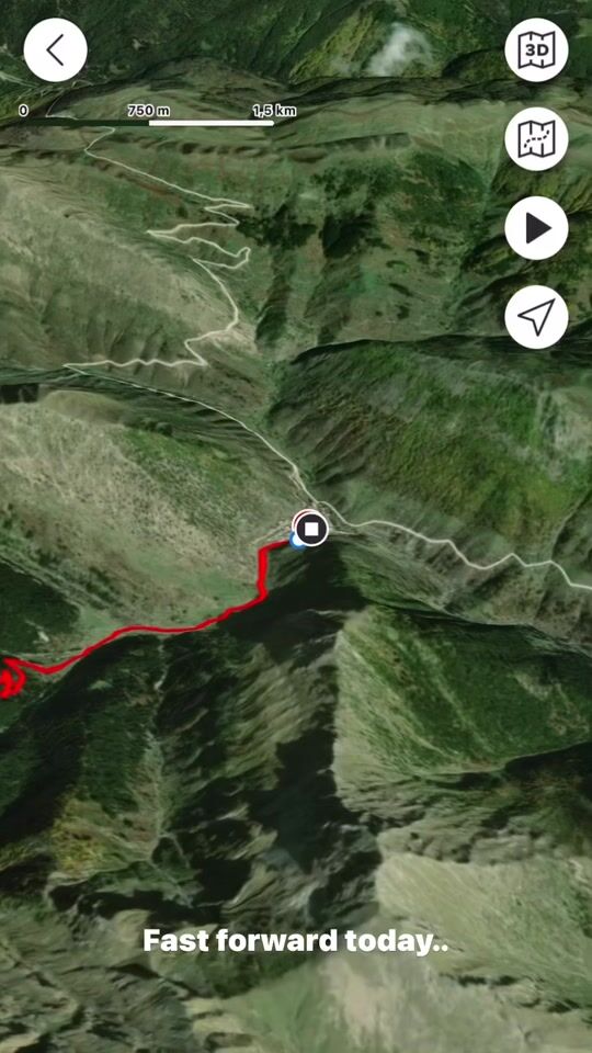
One of its nice features is that you can create or load routes (GPX/KML file) in case you want to go on an unknown trail either for hiking or mountain biking, etc. It is interesting to note here that now most mountain races on the organizers' pages have GPX files, so you download it, upload it via the app, and do an extensive reading of the race if you want, through the maps of the app itself. Of course, you can have the route visible on the watch with navigation indications. For example, I used it in the Zagori run since it was the first year I tried it and I didn't know the topography of the route at all. In the Suunto app, the map has a 3D function (like in Google Earth) and you can see the terrain's morphology (I am attaching a video).
In terms of measurement accuracy, I checked the watch in flat running, trail running, and hiking. I am impressed with its GPS accuracy even in places where the mobile has no signal at all. It is incredibly precise to the point that looking at the route you took, it has recorded even from which side of the trail you passed. You can also set your measurements in intervals, for example, if you want to close a measurement cycle after a certain distance or time (e.g., every 10 minutes or every kilometer). The features it has are countless (it even has a function for paragliding) so the watch will definitely be tested in other activities over time.
The battery life is about 5-6 days with the heart rate monitor on only during exercise, meaning 5 times a week for about 2 hours. If you leave it permanently on and have sleep tracking and stress recovery functions active, it will definitely consume faster. I keep the latter permanently off. It takes time to charge, but I think this can be solved with a good charger.
What remains from the watch is that it was made for purely athletic activities. It is not the classic customizable smartwatch where you can put any wallpaper you want, etc. If sports are a part of your daily routine, then yes, it is worth getting it. If not, there are cheaper options available. I will return at some point with a more complete picture.
MINI UPDATE 25/11/2023
Barometer.
The region of Epirus today experienced something that experts say happens once every 100 years. While the atmospheric pressure is about 1020 hPa, today we had about 980 hPa with values fluctuating locally. The watch synchronized perfectly with the atmospheric pressure! It will definitely have similar results at high altitudes.
MINI UPDATE 29/08/2024
Almost a year after its purchase.
The most important things I want to mention are three things.
1. Far from the sea. It is written in forums, but if you don't see it for yourself, it doesn't mean anything. I don't know exactly what percentage the altimeter is affected by the barometer and what by the satellites and GPS, but as soon as the watch approaches the coast, the altitude starts to play in crazy ranges (it recorded -135 meters). We are talking about depths where even if you wear a diving suit, you won't reach. Also, swimming in a river, the same exact thing. As soon as the watch is in the water, the barometer goes haywire and records whatever altitude.
2. GPS and route tracking. I mentioned it above, I am extremely satisfied. The only point where it lost the route in the year I have been using it was in the gorge of Mythika. Those who have been to that specific point will understand the reason. Great slope, reflection error, and terrain nestled among tall rocks are likely to affect the GPS, which surprisingly recovered very quickly!
3rd. Altitude recording. Calibration before starting the exercise recording and everything is fine. It loses a bit, as is logical, but it's not something that will leave you dissatisfied. For example, the watch performed very well with route recordings in Tymfi, Smolikas, Grammos, Olympus, and Tzoumerka.
I hope this "sheet" for the review didn't tire you. I wish I won't have to come back again. Safe and enjoyable routes to those who made it this far!


 Technology
 Home & Garden
 Fashion
 Sports & Outdoors
 Health - Beauty
 Baby & Kid
 Auto - Moto
 Business - B2B
 Books
Books